Why travel the Pamir Highway
The M41, known as the Pamir Highway, was built in the Soviet era to connect the Pamirs with the rest of Central Asia. Today it is one of the most celebrated road trips in the world. Over a week or more you drive through narrow gorges, past villages hidden in green oases, along the Afghan border and onto a vast plateau at altitudes where few people live.
The people are a big part of the journey. In the western Pamirs, families speak Pamiri languages and live in traditional houses with a skylight above a central room. Homestays offer a simple bed, home-cooked food and warm hospitality.
The route
Dushanbe to Khorog
Most journeys start in Dushanbe. The road to Khorog follows the Panj river for long stretches, with Afghan villages visible across the water. It usually takes one long day or two shorter ones.
The Wakhan valley
From Khorog, many itineraries take the southern route through the Wakhan valley instead of the main road. Here you find the ruins of the Yamchun and Khaakha fortresses, the Bibi Fatima hot springs, petroglyphs near Langar and views of the Hindu Kush peaks in Afghanistan and Pakistan.
The plateau and Murghab
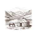
Leaving the valley, the road climbs onto the high plateau of the eastern Pamirs. The landscape changes to open desert, with Kyrgyz herders and their yurts. Murghab is the main town, a simple place of mud-brick houses at around 3,600 metres.
Karakul and on to Osh
North of Murghab, the road crosses the Ak-Baital pass and passes Karakul, a large high-altitude lake. Then it crosses into Kyrgyzstan and descends towards Sary-Tash and Osh.
How many days
- 7–8 days: Dushanbe to Osh with the Wakhan valley, at a brisk pace.
- 9–12 days: add rest days, walks and extra time in the Wakhan.
- 14+ days: combine with the Fann Mountains, or start in Uzbekistan.
Best season
The reliable season is July to September, when high passes are clear and the valleys are green. June is possible but some passes may still have snow. From October, the weather turns cold quickly on the plateau. Our guide to the best time to visit Central Asia shows how to fit the Pamirs into a wider trip.
Altitude and practicalities
Altitude is the biggest factor. We plan the route to gain height gradually and avoid sleeping too high on the first nights. Bring warm clothing, sun protection and any medicines you need, and consult your doctor before the trip if you have health concerns. Fuel, food and accommodation are limited in remote areas, which is why an experienced driver and a well-planned program matter.
Permits and borders
You need a visa or e-visa for Tajikistan and a separate GBAO permit for the Pamirs. The border crossing into Kyrgyzstan at the Kyzylart pass is used by travellers heading to Osh, but its status and rules can change. Read more in our guide to border crossings in Central Asia.
Information checked in October 2026; entry rules change, so confirm with our team or the official embassy website before you travel.
Where it fits in a route
The Pamir Highway is a trip in itself, but it links naturally with Kyrgyzstan: finish in Osh and continue to Song-Kul, Issyk-Kul and Bishkek. It can also be added after Uzbekistan, flying from Tashkent to Dushanbe.
Plan your Pamir journey
Send us your dates, group size and preferred pace. We arrange 4x4 vehicles with drivers, permits, homestays and guides, and send you a program and quote.